“I knew a man who went to [Lake Tahoe] to die. But he made a failure of it. He was a skeleton when he came, and could barely stand. He had no appetite and did nothing but read tracts and reflect on the future. Three months later he was sleeping out of doors regularly, eating all he could hold, three times a day, and chasing game over mountains three thousand feet high for recreation. And he was a skeleton no longer, but weighed part of a ton. This is no fancy sketch but the truth. His disease was consumption. I confidently commend his experience to other skeletons.” – Mark Twain
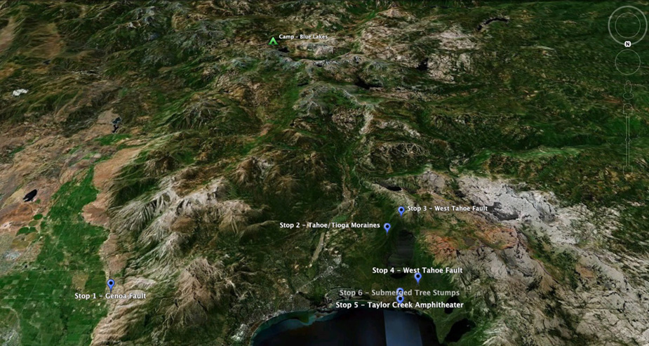
Overview of stops scheduled for Friday in the southern Lake Tahoe area. View to the south.
For details on Friday's scheduled talks, click here.
Stop 1 - Mott Canyon at base of Kingsbury Grade (D. Rood and A. Ramelli) [38.928364° -119.839596°]
Stop 2 - Fallen Leaf Lateral Moraines (G. Seitz) [38.887141° -120.050923°]
Stop 3 - Angora Lakes [ 38.871860° -120.064267°]
West Tahoe Fault (WTF) well-defined multiple-event scarp (G. Seitz)
Fallen Leaf Lake Paleoseismology (G. Kent)
Stop 4 - West Tahoe Fault (WTF) North Fallen Leaf Lake Lateral Tioga-age Moraines (G. Seitz)
[38.926747° -120.069884°]
Stop 5 - Taylor Creek Visitor Center [38.937850° -120.055221° ]
Holocene Subaqueous Paleoseismology of Lake Tahoe (Smith)
Geodetic Constraints (Hammond)
Offshore Faulting (Kent)
Onshore Extend of West Tahoe Fault based on LiDAR (Seitz)
Stop 6 Baldwin Beach - Submerged Tree Stumps on the WTF Hangingwall Block (G. Seitz, G. Kent)
“So singularly clear was the water, that where it was only twenty or thirty feet deep the bottom was so perfectly distinct that the boat seemed floating in the air! Yes, where it was even eighty feet deep. Every little pebble was distinct, every speckled trout, every hand's- breadth of sand. Often, as we lay on our faces, a granite boulder, as large as a village church, would start out of the bottom apparently, and seem climbing up rapidly to the surface, till presently it threatened to touch our faces, and we could not resist the impulse to seize an oar and avert the danger. But the boat would float on, and the boulder descend again, and then we could see that when we had been exactly above it, it must still have been twenty or thirty feet below the surface. Down through the transparency of these great depths, the water was not merely transparent, but dazzlingly, brilliantly so. All objects seen through it had a bright, strong vividness, not only of outline, but of every minute detail, which they would not have had when seen simply through the same depth of atmosphere. So empty and airy did all spaces seem below us, and so strong was the sense of floating high aloft in mid-nothingness, that we called these boat-excursions ‘balloon-voyages.’” - Mark Twain
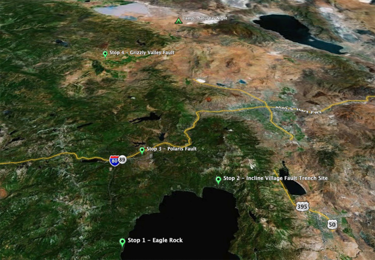
Overview of stops scheduled for Saturday in the northern Lake Tahoe/Sierra Valley area. View to the north.
For details on Saturday's scheduled talks, click here.
Leave camp at 9:00 AM
Drive north on Hwy 88 & 89 around the west shore of Lake Tahoe.
Stop 1 - Eagle Rock - McKinney Bay slide and offshore fault architecture (G. Kent)
[39.107091° -120.161469°]
Stop 2 - Incline Village Fault, Southwood School trench site (Seitz, Kent)
[39.248936° -119.963720°]
Stop 3 - Polaris Fault (Hunter, Howle) [39.337443°-120.143203°]
Stop 4 - Grizzly Valley fault system, Sierra Valley CA (R. Gold) [39.792875°-120.316098°]
Transistion to the Translational Regime (J. Bormann)
Drive to Fort Sage area and camp on BLM land(?)
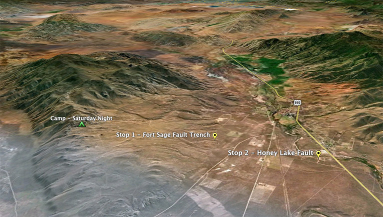
Overview of stops scheduled for Sunday near Doyle. View to the south. **Location of Sat. night camp will likely change.**
For details on Sunday's scheduled talks, click here.
Stop 1 - Fort Sage fault, Doyle CA (Briggs) [40.057852°-120.088482°]
Stop 2 - Honey Lake fault, Doyle CA (Briggs et al.) [40.054694°-120.122511°]
Thanks for another great FOP. Have a safe drive home.